Tagged: long exposure

CF8994 240922 190147

CB0509 231003 104720

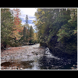
Oh man, where to start? This was “the story” from this trip; I saw so many very cool waterfalls, but this one, this one was interesting to find. My only directions for this location were that you turned down this particular forestry/logging road, and then “when the road forks, take the right side; the left side is VERY muddy after it rains. Once you cross the bridge, there is a pull over on the right side…” Well, it had just rained, so as I started down the glorified two-tracker, I watched for the fork in the road.

As I drove along it got muddier and muddier, but my Traverse has all wheel drive, so I wasn’t too concerned. Then I crested a hill and there was a small pool of muddy water at the bottom. Since there were tire tracks through it already, I assumed that there wasn’t anything dangerous in the water and I proceeded down the hill, through the mud, and then up the hill. As I crested the other side, there was another depression with more mud but just a little bit wider with more mud. Over the next 3 or 4 hills, each mud hole was a bit deeper and a bit wider.

As I crossed the 6th or 7th hill, the valley below was less of a small pool or muddy water, and almost a pond. It was at this moment that it occurred to me; not only have I travelled farther then the guide indicated, but now I have to turn around and head back through all of those increasingly deep mud puddles that I just made ruts in. Using my genius intellect, I assumed that the best way to avoid being stuck was to go as fast as possible through the puddles. There was one puddle where I felt the rear wheels gripping, but not the front wheels; but in each mud puddle, the Traverse came through.

So how did I find the waterfall? As I drove back on the two-track, I saw the “bridge” … a series of railroad ties laid across the road that I’d missed because I was looking for the fork in the road first.

CB0515

And yes, my wonderful white Traverse was a bit of a mess for the remainder of the trip. 🙂

CB0507

CB0484 231003 094527

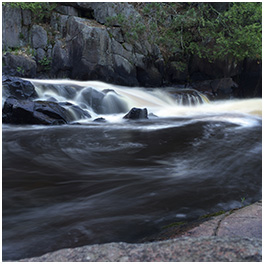
As I walked up from the lower falls which were not very impressive but were very easy to get to; I realized that the land was increasing in height but the river was not. And as this break in the stone cliff came into view, I could tell that Tyler Forks Dells might be quite the sight. But first I had to cross this rock wall that was maybe 15 or 20 feet high.

BZ4527 231003 084706

Upson Falls tumbles over the cascade of rocks and immediately makes a sharp right turn downriver. That sharp turn allows for this spectacular view with the sun rising “up river” and the wonderfully rich hues of morning.

CB0412 231002 170232

BZ4430 231002 145938

The Keweenaw Peninsula does not have much land area for large rivers to form, and this is reflected in some of the waterfalls. Manganese Falls is a very steep fall, but the stream is only 10-12 inches wide.

CB0396 231002 143242

As you climb up the hill beside Jacob’s Falls, the question may cross your mind: “does this all count as one waterfall?” And that is a question that I have wondered many times; how much of a stream’s length must exist between cascades of water before they are considered distinct falls?

CB0388 231002 142544

Jacob’s Falls is kinda the perfect Upper Peninsula waterfall. It’s small and unassuming, but literally 20 feet away from the edge of the road. There would be people like myself who would search it out if it were hidden in a forest, but really, the reason that it has a name is because of the highway.

CB0386 231002 141057

You can easily view this dam and falls from a pedestrian bridge over the Eagle River, and as I stood on that bridge, I was impressed by the manmade dam that has stood for (I assume) nearly a century or more. But I was also saddened that I will never see this waterfall tumbling down the rock face with the intensity that nature intended.

CB0378 231002 140358

You can imagine the monstrous noise that this small drop would create during the spring flow, but on a random day in early October it’s a peaceful and tranquil scene.

CB0368 231002 131414

Upper Conglomerate Falls really tested my “what is a waterfall” question. After all, if any river runs dry enough, it will turn into a series of cascades. Getting to this falls was not easy, and it was an overall disappointment. However, the “Upper” part of the name implies a “lower”, and that could lead to a fun falls (or even more disappointment.)

CB0356 231002 112239

The information that I’d gleaned in the 16 hours since I started asking locals about waterfalls had led me to believe that there were three waterfalls – Upper, Middle, Lower. Once I’d found the third waterfall, I hopped back into my car and headed onto the next stop in my day. I only found out a few days later that the Lower Falls is only a few hundred feet downstream from these falls!

CB0345 231002 111522

When I first planned my trip to the Keweenaw Peninsula, I planned on spending the day (Monday) visiting most of the lighthouses; any waterfalls that I could find along the way would just be a bonus. After my trip, I purchased Phil Stagg’s excellent “Waterfalls of Michigan” series of books and discovered that there were 6 waterfalls named “Hungarian”; I only visited the middle 3.  I guess I’ll have to take a trip back in 2025, right?

BZ4068 231002 100315

The Hungarian Falls is a series of cascades just outside of Hubbell along Dover Creek. I particularly enjoyed the distinct trickles of water in the Upper Falls.

CB0322 231002 084610

Canyon Falls is an easy hike, and the entire time you wonder “Is there really a Canyon?” and then you HEAR the falls.
It’s actually a little tricky to get to the falls, especially with a tripod and camera, and once you get down this close to the lower portion, it’s still not easy to see the falls in its full glory, since you’re off on the side. But there is no doubt, Canyon Falls is a powerful and loud falls.

BZ3807 241002 064131

What a beautiful and surprising way to start my trip! I arrived in the U.P. late on Sunday night and asked the employees at the Subway in L’Anse if there were any waterfalls around; after all, I have plenty of lists of waterfalls for Wisconsin, but at that point, I didn’t have any formal list for the U.P. They pointed out that Powerhouse Falls was just outside of town and very beautiful. So, bright and early the next morning, I wandered over to find this absolutely stunning waterfall.


CF2713 240519 212616

This was an interesting concept, but poor execution. The idea was that the sparks from the steel wool would look like they were coming out of the tailpipe, but – well, you gotta have your angles right. And since that’s me spinning the steel wool, well, my camera angle was all wrong. Oh well, I still think it’s a cool shot of Keith on his bike.

…view older images with the thumbnails below…


CF2707 240519 210040

…view older images with the thumbnails below…


CF2704 240519 205335

…view older images with the thumbnails below…


CF2701 240519 204248

Over the past 10 years, the Elgin Area Camera Club has hosted a steel wool photography opportunity three times. This image is from our most recent outing, and I’m actually the one who is spinning the wool in this image – I set up my camera and someone else pushed the shutter, so this is more of a collaborative image, you might say.

…view older images with the thumbnails below…


CF2699 240519 203855

…view older images with the thumbnails below…


CF2698 240519 203521

…view older images with the thumbnails below…


CF2690 240519 202309

…view older images with the thumbnails below…


“Hidden Falls”

May 18th, 2024

There are definitely times of the year when Upper Bear Hollow Falls are flowing enough to be impressive, but early April is not one of them. …view older images with the thumbnails below…  

CD4117 240409 081217

There are definitely times of the year when Upper Bear Hollow Falls are flowing enough to be impressive, but early April is not one of them.

…view older images with the thumbnails below…


CD4112 240409 080702

At Turkey Run, Bear Hollow is the intersection of 2 different canyons or valleys. The one valley always has flowing water, but nearly every canyon or valley has been formed by flowing water, and if you look closerly enough, there is water flowing down the tiny canyon at the top of the photo…so that obviously counts as a waterfall.

…view older images with the thumbnails below…


CD3991 240408 165531

…view older images with the thumbnails below…


CD3979 240408 164919

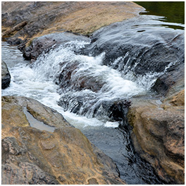
Just a little trickle of a falls that I captured on my way back from the eclipse earlier this year. This waterfall would probably not make it onto anyone’s map or highlights, but at 3 to 4 feet tall, it is just a fun little falls to enjoy.

…view older images with the thumbnails below…


CD3915 240408 153540

CD3411 240408 080636

CD3390 240408 072000


CD4142 240409 084601

Until this point in the trail, you can keep your feet dry, but after this point, while it is possible to not get your feet soaked, it’s almost required to walk part of the way in the stream. But it’s all worth it, because this path leads to the Punch Bowl and to the “One Hundred Inch Falls” (my name for the location on Trail #4).

…view older images with the thumbnails below…

CD4094 240409 080058
 

When I visited Turkey Run State Park the first time, back in 2022, I ran out of time and walked right past Bear Hollow without capturing any photos.  However, the first photo that I saw from Turkey Run was from Bear Hollow with its iconic ladders – so adding Turkey Run and Bear Hollow to my return trip was an easy decision.

…view older images with the thumbnails below…

CD4027 240408 181931

…view older images with the thumbnails below…

CD3976 240408 164833

As I headed north from Cataract Falls to Turkey Run, I mostly meandered through the back roads. On one road there was a sign “Cagles Mill Dam” pointing to a side road. The road ended right before it crossed the top of the dam wall; honestly, it was a pretty impressive view. But I noticed that the downstream area appeared to be a rocky canyon, and as I drove down to the bottom of the damn, I was rewarded with this tiny waterfall – maybe a total of 4 or 5 feet tall.

…view older images with the thumbnails below…

CD3432 240408 080933

When I arrived at Cataract Falls in Indiana, I asked one of the park rangers if she knew of other waterfalls in the area. She pointed out that if you walk AWAY from Mill Creek (and Lower Cataract Falls), you’ll encounter Little Sister Falls. Little Sister Falls ended up being 2 distinct small cascades about 60 feet apart; the perfectly intimate waterfalls that I love being near.

…view older images with the thumbnails below…

CD3398 240408 075645

Upper Cataract Falls is listed as the largest waterfall in Indiana (by volume); it wasn’t easy to photograph due to the vegetation, but it would likely be even harder to photograph when the vegetation has filled in.

…view older images with the thumbnails below…

CD3384 240408 071348

Why yes, of course, I did visit several waterfalls while I was in southern Indiana for the eclipse. I am legally obligated to visit waterfalls anytime that I travel farther than 45 miles from home.

…view older images with the thumbnails below…