“Horse Tail Falls”
October 29th, 2024
a daily photo from joshua l. smith


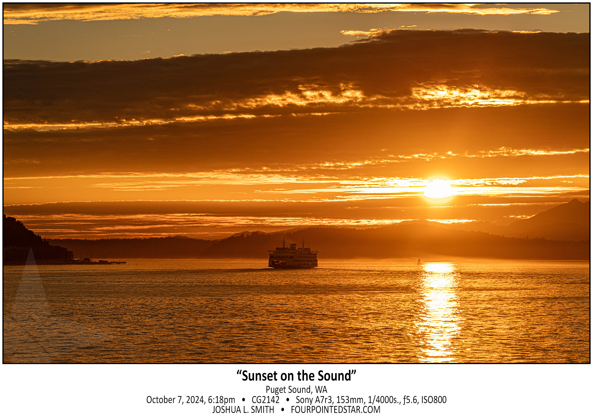


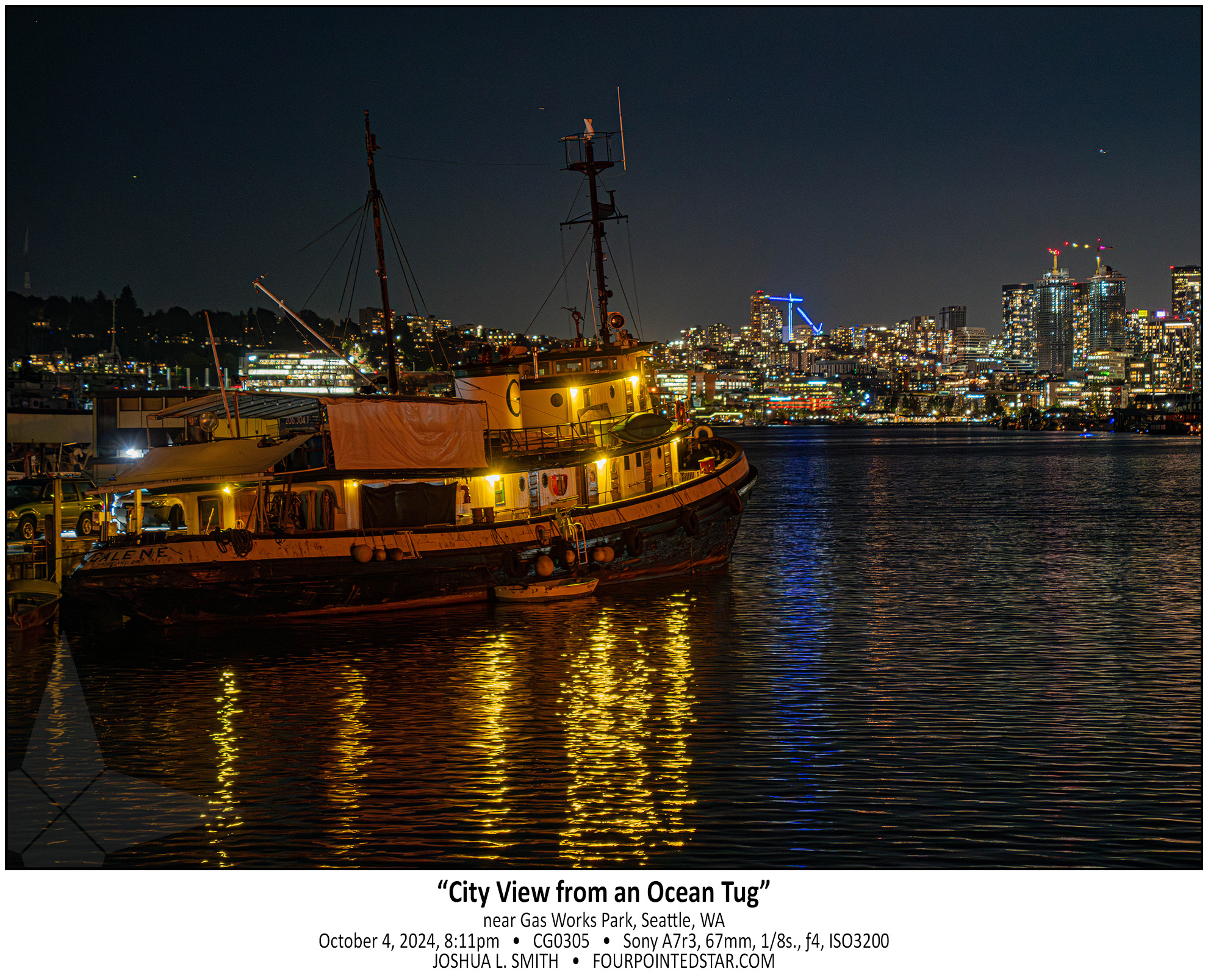
Our human sense of scale is often inadequate for what is around us; that tugboat is huge, longer than a semi truck. But that tugboat pales in comparison to even the small “lake” that it’s floating in, Lake Union.


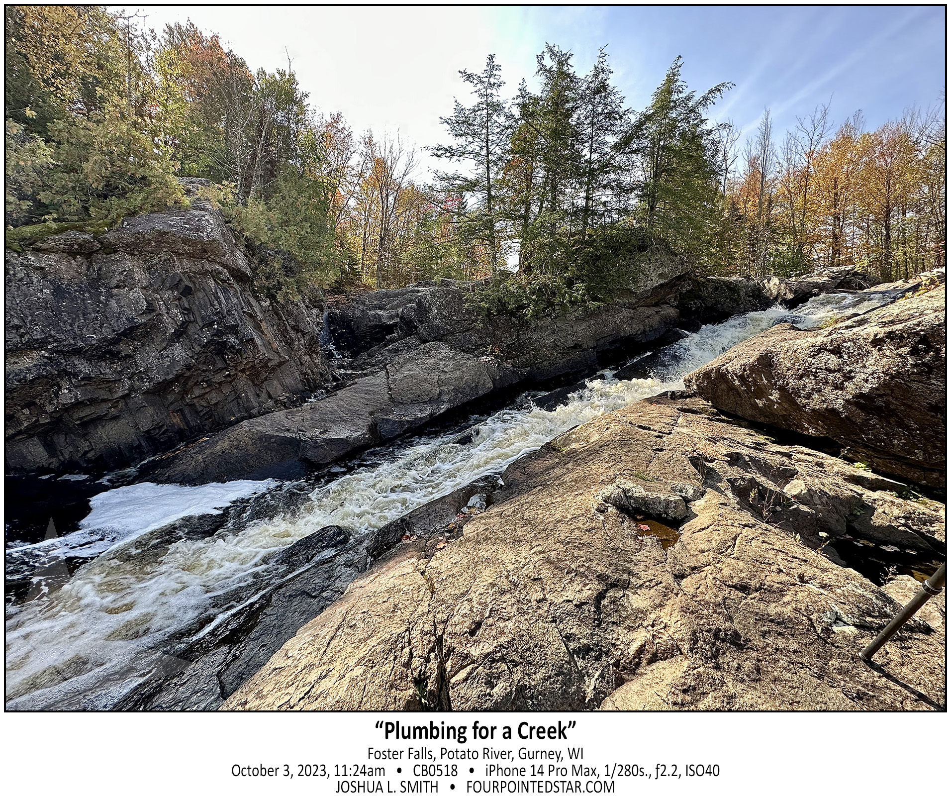
This series of falls reflected an incredible decrease in elevation. This is the last segment of large falls, but there is significant series of rapids and cascades even further down the stream and the entire area is filled with incredible sights and scenes.
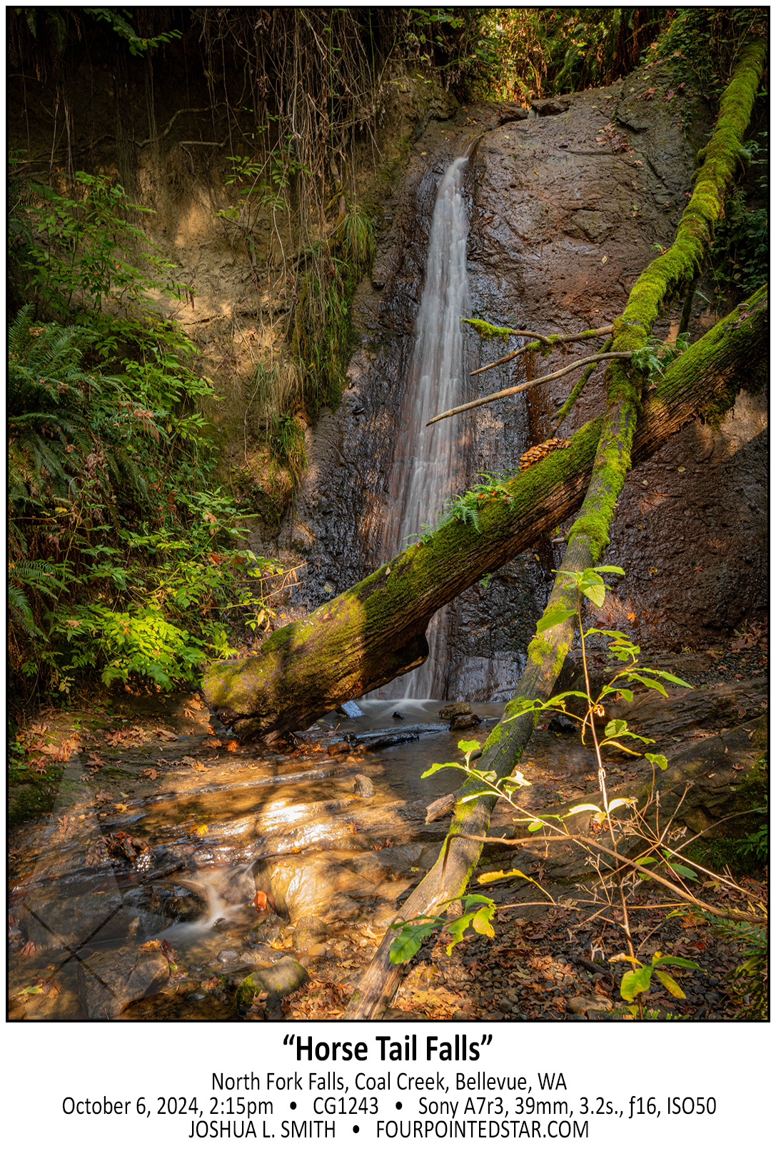
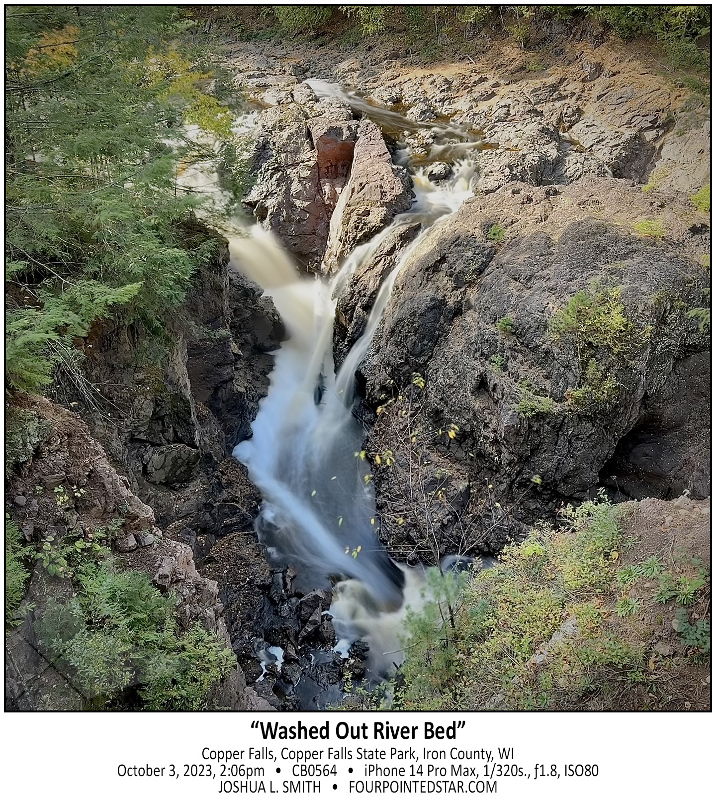
As we drove out of the woods, I realized that we could park alongside the road and see a part of the falls. Then once we walked to the bridge over the stream, you could see a walkway under the bridge, so of course, I climbed down to the walkway to capture this photo!
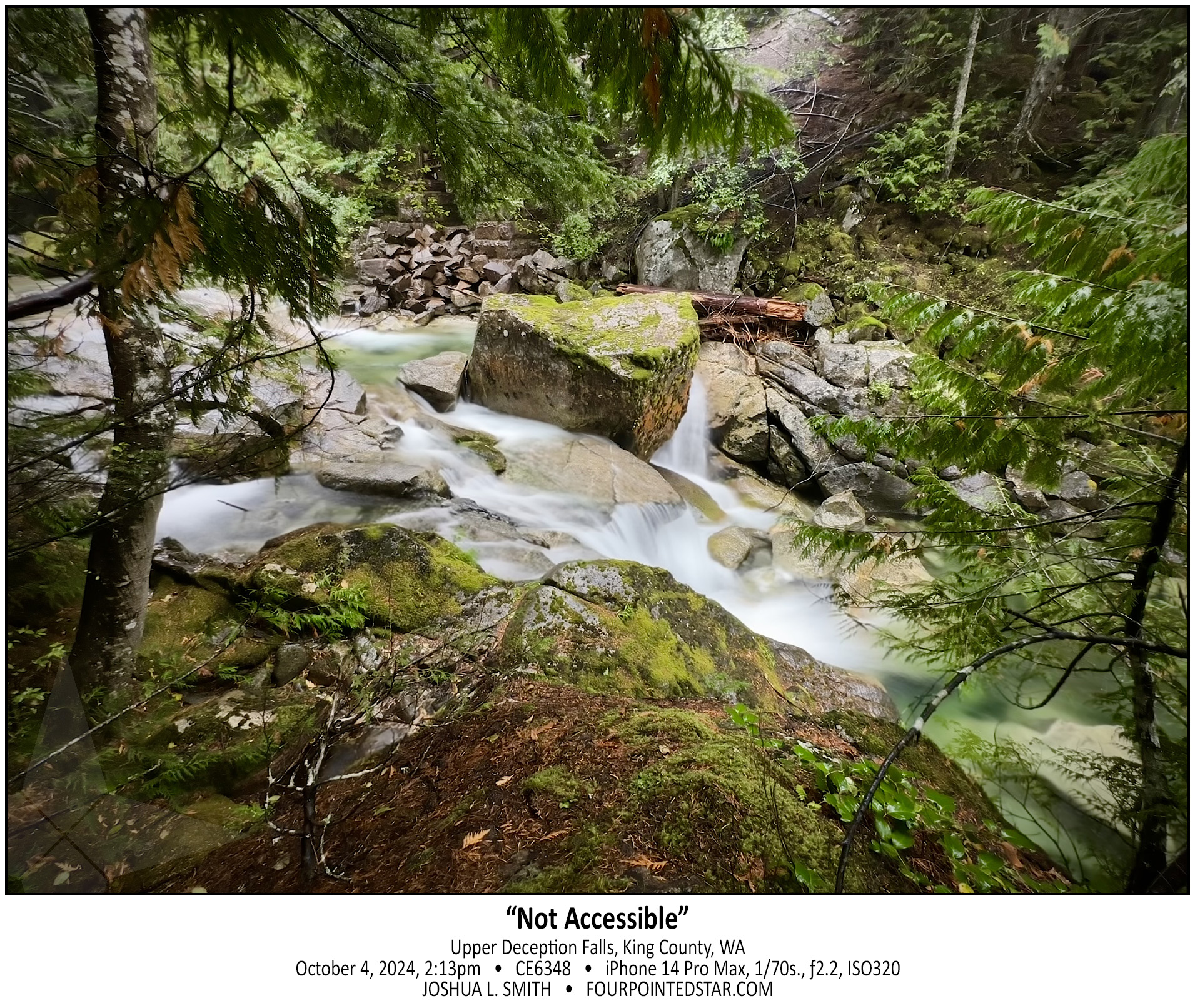
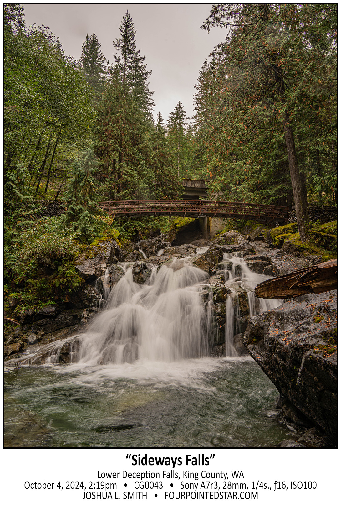
Before our October 2024 trip to Seattle, I bought a “Washington Waterfalls” book and picked out a couple of sets of easy hikes. Our first waterfall adventure was to visit a few that were along Hwy. 2, and at our first stop, the parking lot was closed. After looking at the map, I realized that there may be a different way to see the falls. Technically I was right…technically. As we drove up the dirt road, it got increasingly steep and less likely to lead to an accessible path.
We parked precariously, and I clambered down the hill to see if I could get a photo. The water was a crisp bluish-green, and since it was raining that morning, I was not comfortable with crawling all over the rocks like normal, but even from my vantage point, the scene was incredible.
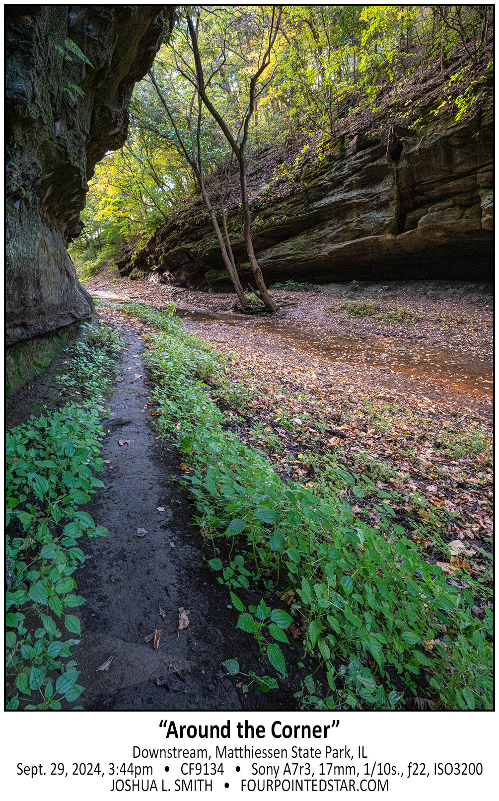
Just fair warning, if it has rained recently, and you decide to walk downstream at Matthiessen, your feet will get muddy or you’ll walk in the streamed itself. And maybe both…

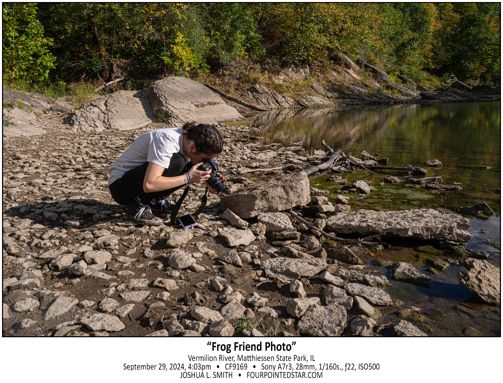
My daughter and I visited Matthiessen back in 2018, and we walked upstream that time. So this time, we visited the main waterfall area; then we walked downstream this time – all the way to the Vermilion River. The Devil’s Paintbox is right by the main stairs down to see the main waterfall area, and honestly, it’s not that exciting except for the copper colored stream that was very slowly flowing out of the alcove.
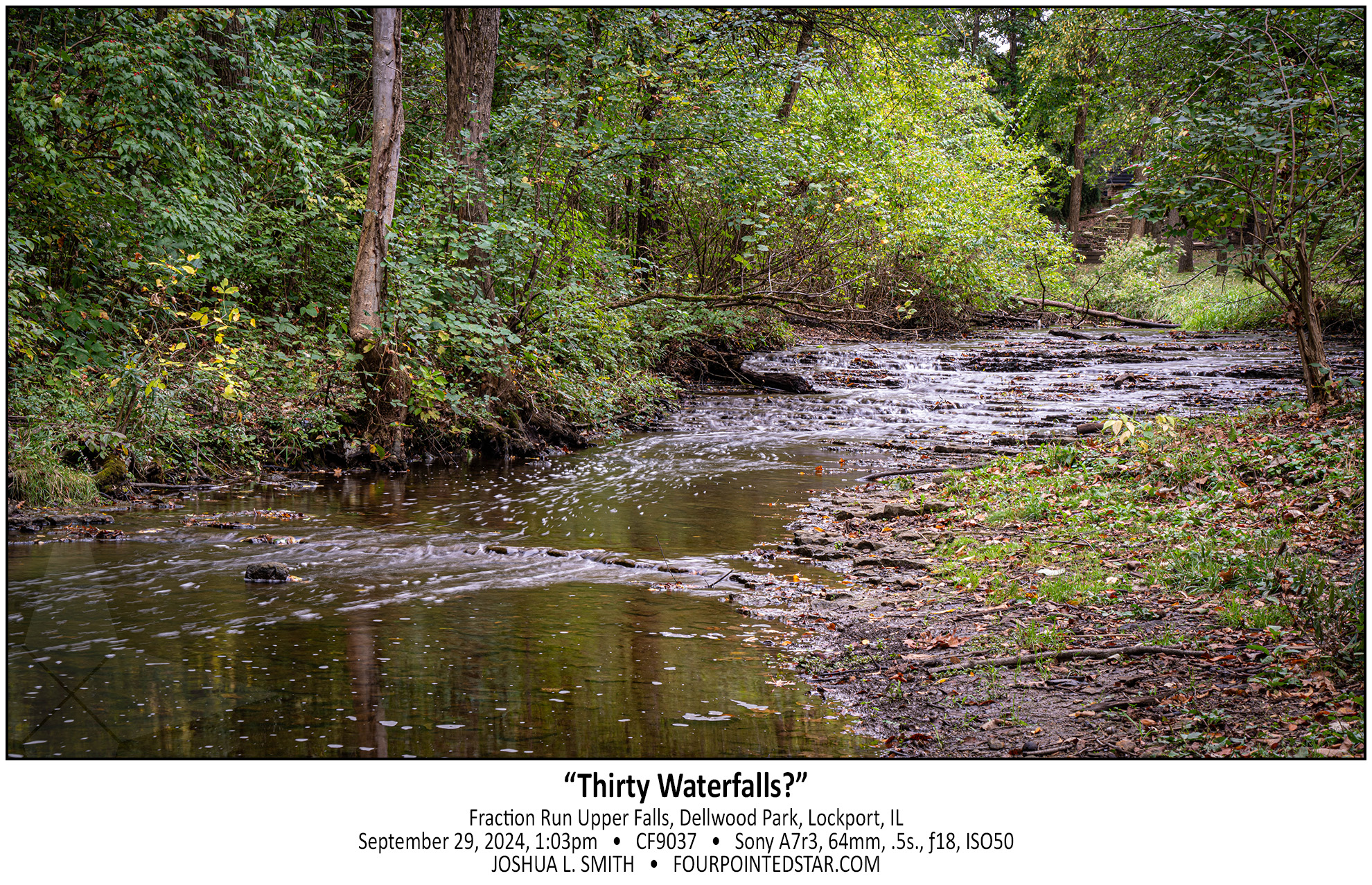
Not only did we find a waterfall in Dellwood Park along Fraction Run Creek, we found two! This waterfall is probably widely known – it’s right on the frisbee golf path; the other waterfall is a little harder to get to. There are likely more drops as well, but they would only be accessible by walking through the stream.
I’ve written a few times about “what is a waterfall”, so I would ask – Is this 1 cascade or 30+ individual falls? 

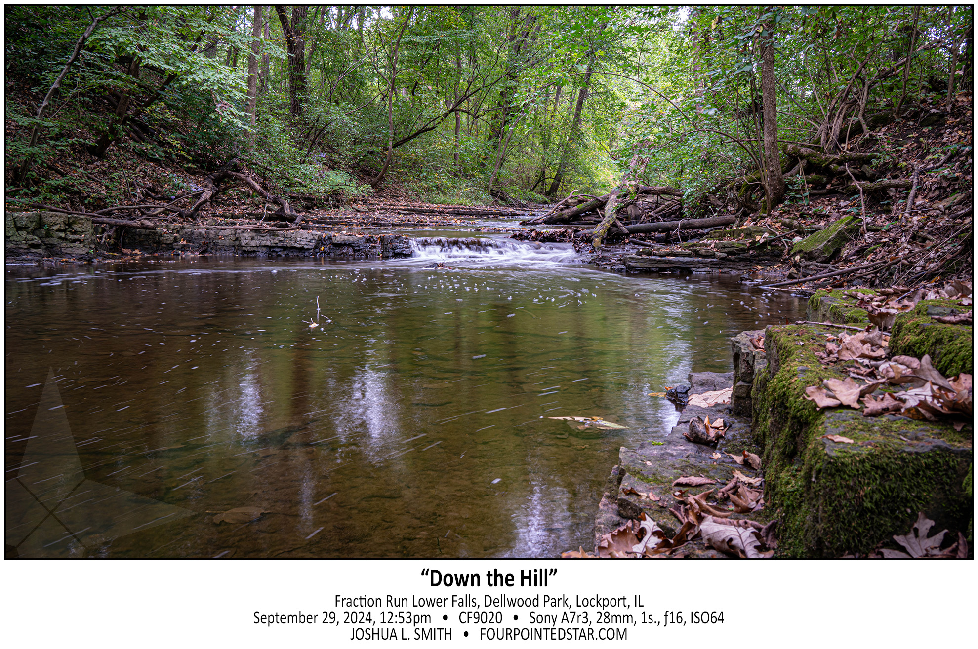
While I was visiting Sagawau in Cook County, one of the park employees mentioned that there may be a waterfall in Dellwood Park in Lockport. Since I have a client in Lockport, I already knew that there was a stream in a valley in Dellwood Park, and I was disappointed that it hadn’t occurred to me that there was likely to be a waterfall in that valley. So, the next available weekend, my oldest daughter and I went on a hike to see if we could find a waterfall along Fraction Run Creek…

Oh man, where to start? This was “the story” from this trip; I saw so many very cool waterfalls, but this one, this one was interesting to find. My only directions for this location were that you turned down this particular forestry/logging road, and then “when the road forks, take the right side; the left side is VERY muddy after it rains. Once you cross the bridge, there is a pull over on the right side…” Well, it had just rained, so as I started down the glorified two-tracker, I watched for the fork in the road.
As I drove along it got muddier and muddier, but my Traverse has all wheel drive, so I wasn’t too concerned. Then I crested a hill and there was a small pool of muddy water at the bottom. Since there were tire tracks through it already, I assumed that there wasn’t anything dangerous in the water and I proceeded down the hill, through the mud, and then up the hill. As I crested the other side, there was another depression with more mud but just a little bit wider with more mud. Over the next 3 or 4 hills, each mud hole was a bit deeper and a bit wider.
As I crossed the 6th or 7th hill, the valley below was less of a small pool or muddy water, and almost a pond. It was at this moment that it occurred to me; not only have I travelled farther then the guide indicated, but now I have to turn around and head back through all of those increasingly deep mud puddles that I just made ruts in. Using my genius intellect, I assumed that the best way to avoid being stuck was to go as fast as possible through the puddles. There was one puddle where I felt the rear wheels gripping, but not the front wheels; but in each mud puddle, the Traverse came through.
So how did I find the waterfall? As I drove back on the two-track, I saw the “bridge” … a series of railroad ties laid across the road that I’d missed because I was looking for the fork in the road first.

And yes, my wonderful white Traverse was a bit of a mess for the remainder of the trip.

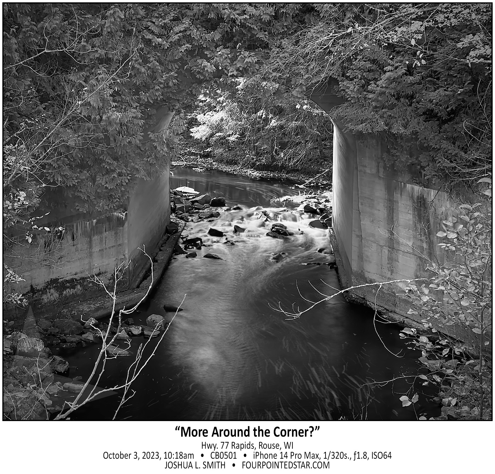
I have 3 waterfall books that indicate that there is a waterfall or at least a larger rapids on this stream, and one of the books indicates that it is easy to reach. Without climbing down into the stream and then walking under the concrete culvert, I can’t tell if there is anything upstream. I also am VERY hesitant to walk upstream without knowing or seeing some indication that the land is still undeveloped at the least. So, this rapids/waterfall/something waits for another trip.
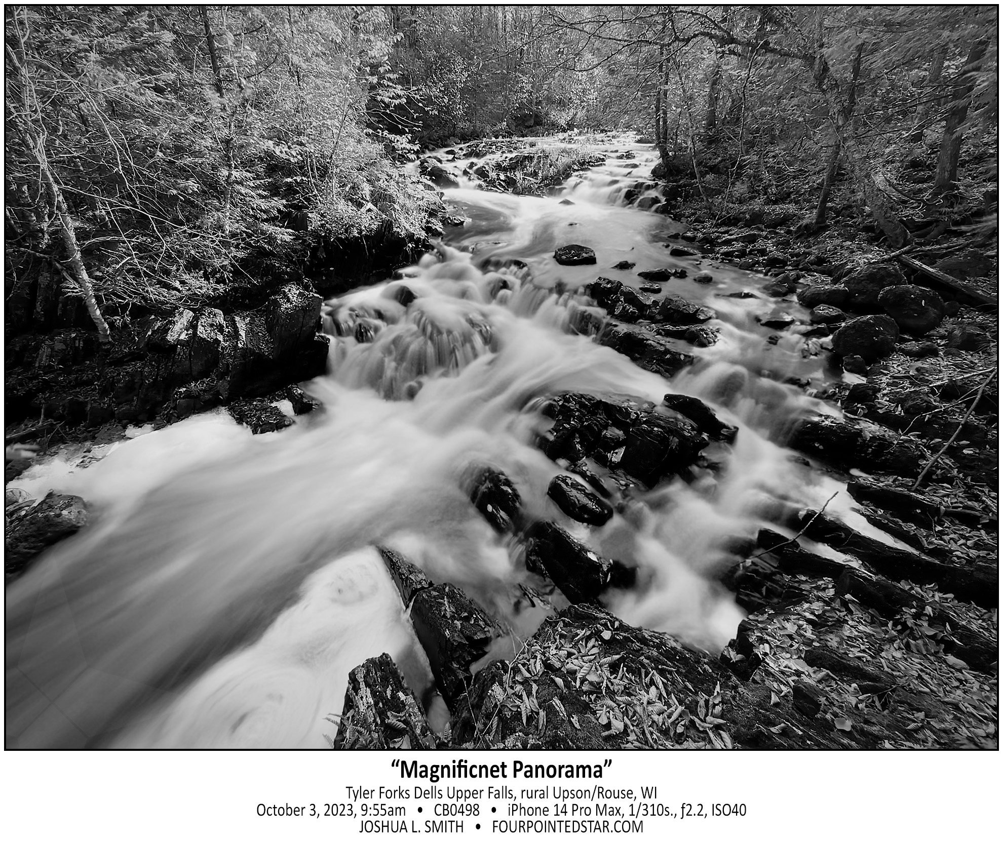
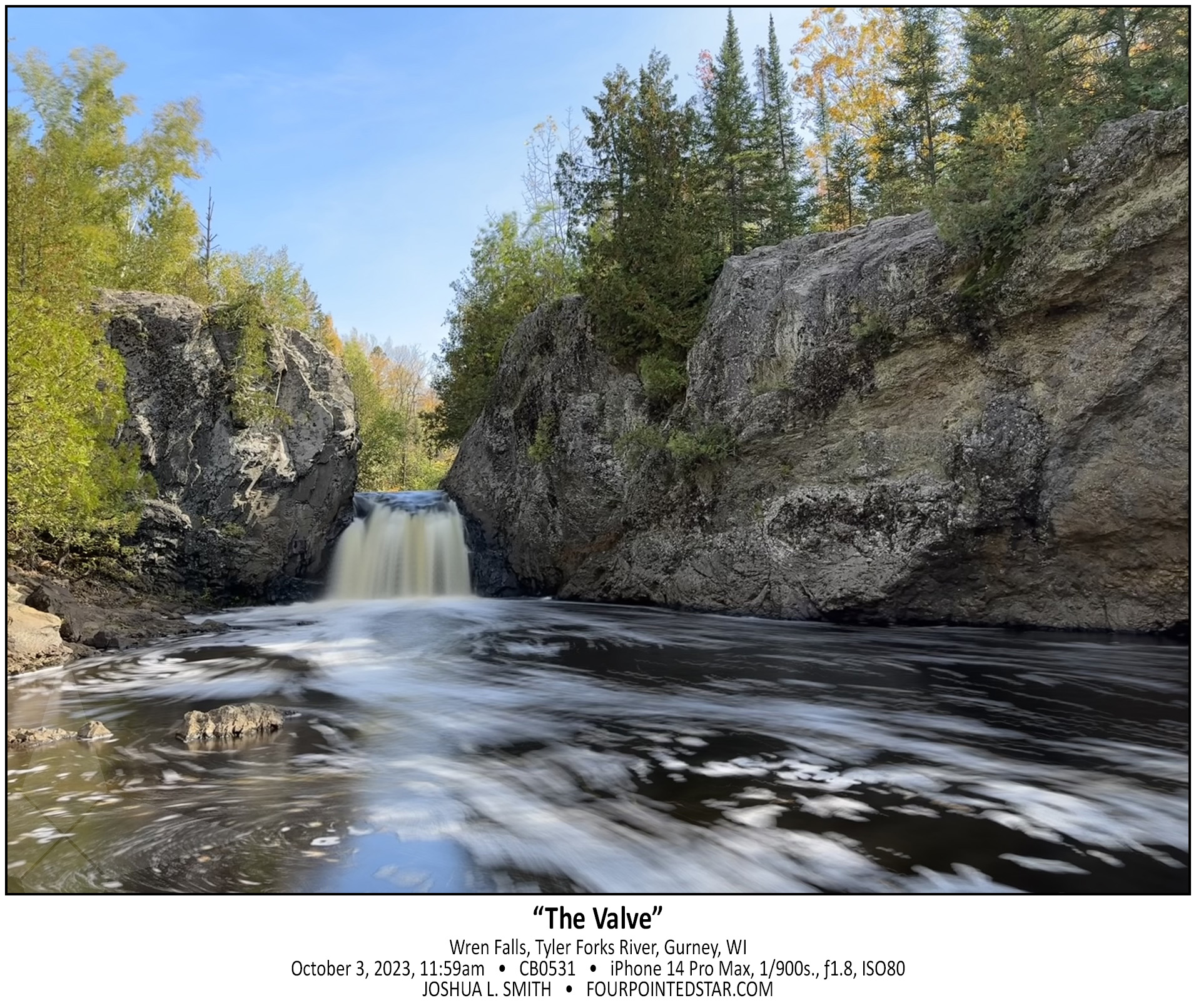
As I crested the hill so that I could see the rapids behind, I was literally awestruck by the view of Tyler Forks Dells Upper Falls. I gasped something like “that’s incredible!” as the scene came into view. The guide that I had stated “a series of small rapids forming an S curve”, but did NOT prepare me for how beautiful the Upper Falls are. The falls at the rear of the image are probably 200-250 feet away, which provides you with a sense of how expansive this view is. Although, you can’t tell it in this monochrome, the pops or orange leaves on the dark rocks, the yellow foaming water, and the sunlight illuminating the far side of the river added to beauty.
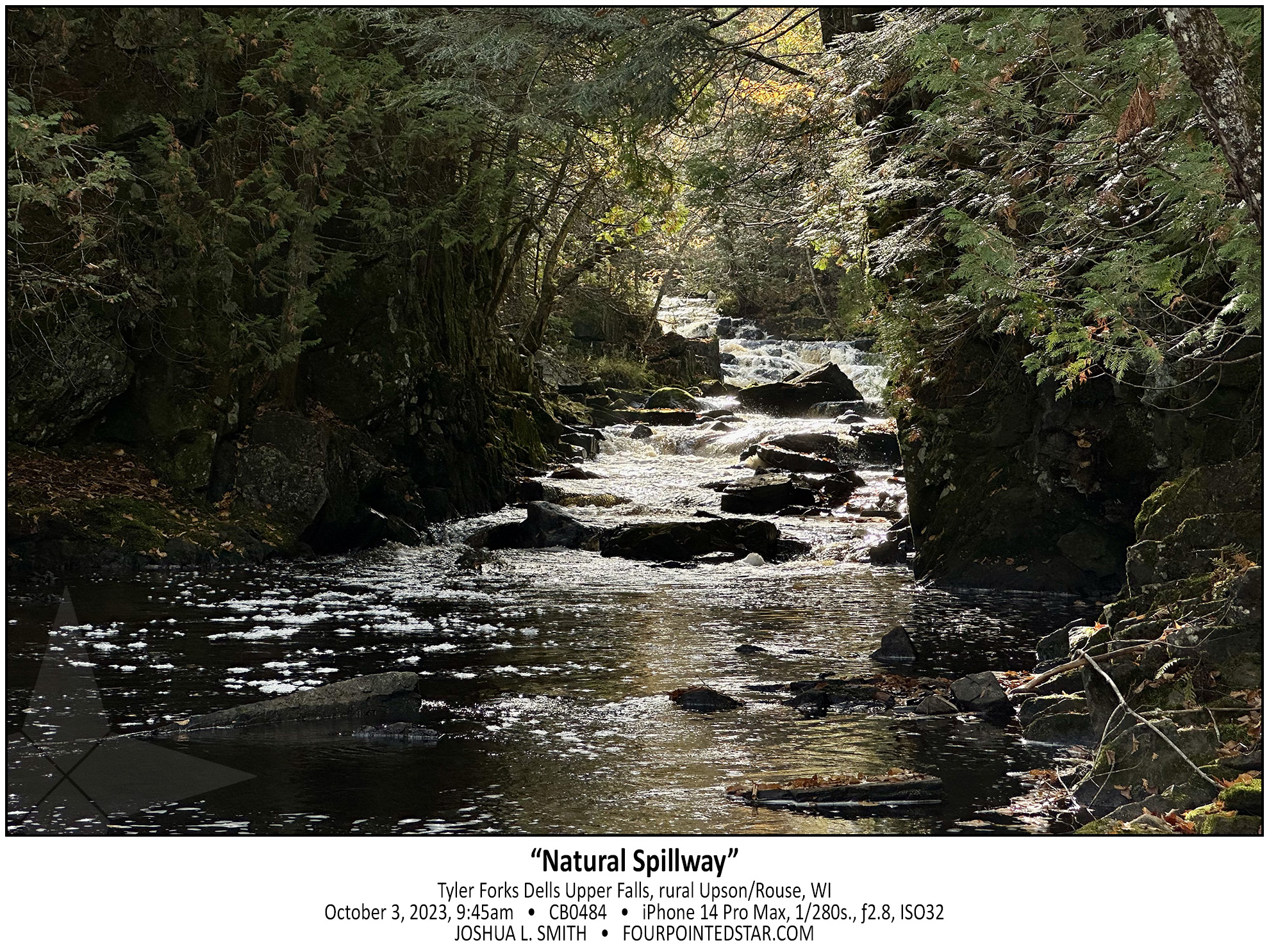
As I walked up from the lower falls which were not very impressive but were very easy to get to; I realized that the land was increasing in height but the river was not. And as this break in the stone cliff came into view, I could tell that Tyler Forks Dells might be quite the sight. But first I had to cross this rock wall that was maybe 15 or 20 feet high.


Upson Falls tumbles over the cascade of rocks and immediately makes a sharp right turn downriver. That sharp turn allows for this spectacular view with the sun rising “up river” and the wonderfully rich hues of morning.


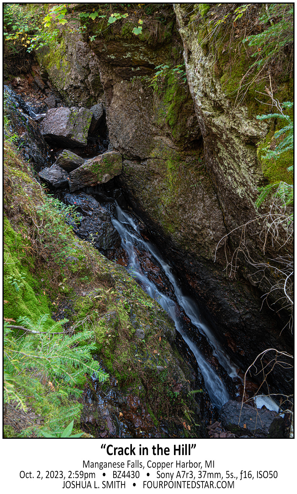
The Keweenaw Peninsula does not have much land area for large rivers to form, and this is reflected in some of the waterfalls. Manganese Falls is a very steep fall, but the stream is only 10-12 inches wide.
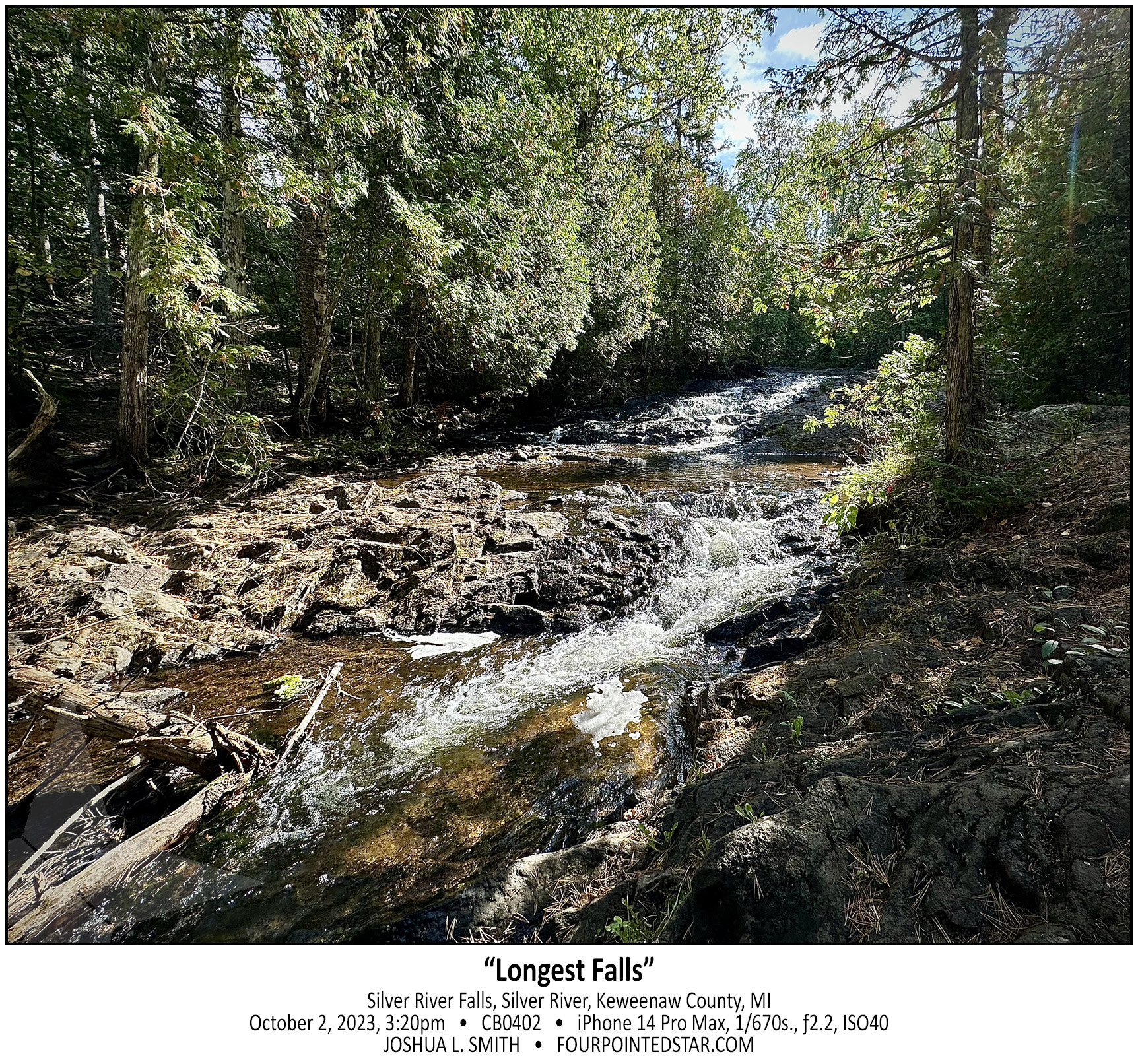
Silver River Falls is another very accessible waterfall. Michigan Highway 26 crosses over the Silver River and there is information describing the falls and the bridge along with some parking. However, Silver River Falls isn’t one cascade; it is a series of several small cascades spread along a few hundred feet of the Silver River. This photo was taken 150 feet or so down the river and there were more cascades further downriver as well.
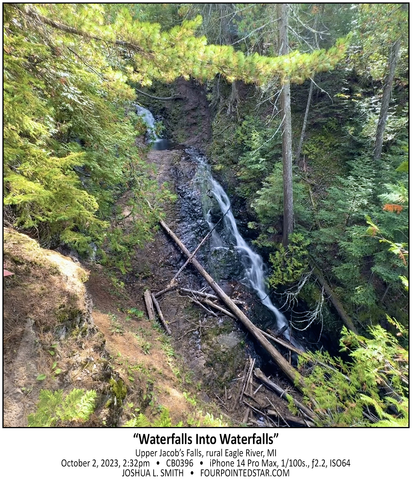
As you climb up the hill beside Jacob’s Falls, the question may cross your mind: “does this all count as one waterfall?” And that is a question that I have wondered many times; how much of a stream’s length must exist between cascades of water before they are considered distinct falls?